How Quartet Detects Aircraft from Space
Created by Brady Africk | Updated August 4 2026
Exploiting sub-second timing offsets between Sentinel-2 spectral bands to detect moving aircraft as collinear dot patterns in satellite imagery.
B2 (Blue) · B8 (NIR) · B3 (Green) · B4 (Red)
1 The Key Idea
Sentinel-2 satellites take pictures of Earth using separate color filters — blue, near-infrared (NIR), green, and red — but they don't fire simultaneously. The filters fire in sequence over about one second: NIR ~0.26 s, green ~0.53 s, and red ~1.0 s after blue.
For anything on the ground — buildings, roads, fields — this doesn't matter. They don't move, so they look the same in all four images. But an aircraft moving at 800+ km/h covers about 220 meters in that one-second sequence.
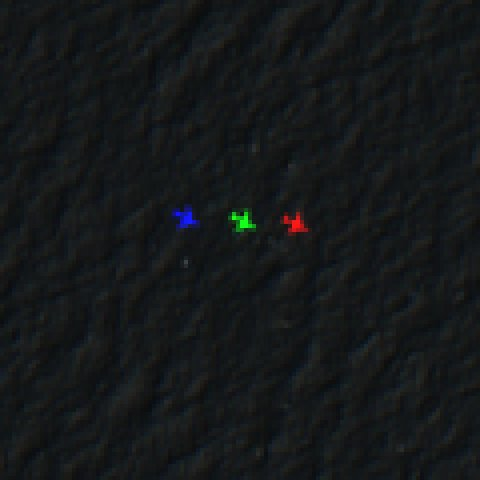
The result: a flying aircraft shows up as four colored dots in a line — blue, NIR, green, red — while everything else on the ground appears as a single, ordinary point.
Real Examples from Sentinel-2
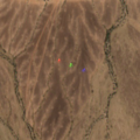
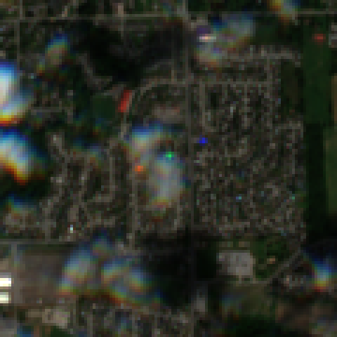
Each image below shows an actual aircraft detected in satellite imagery. Look for the blue, green, and red dots separated along the flight path.
2 Finding Bright Dots
Aircraft are small (a 737 is about 3-4 pixels wide at this resolution) but surprisingly bright. Sunlight reflects off the metal fuselage, making them stand out against the darker ground below.
Quartet scans each color band separately, comparing every pixel to its local neighborhood. Pixels that are significantly brighter than their surroundings are flagged as candidates. Over a typical satellite tile (~110 km wide), this might find thousands of bright spots per color.
The brightness test also adapts to the scene. It relaxes over dark, calm water so faint over-water aircraft aren't missed, and tightens over clouds, snow, and sun-glint, where natural sparkle can mimic aircraft.
3 Matching Triplets
Most bright spots are just noise — rooftops, wave crests, mineral deposits. Quartet filters them by looking for the specific pattern that only a moving aircraft produces: three dots in a straight line with the right spacing (the blue, green, and red dots — the fourth, NIR dot joins in step 5).
The spacing between dots depends on the aircraft's speed (faster = wider spacing), and the line direction reveals its heading. The green-red gap is roughly 0.907× the blue-green gap (set by the satellite's band-capture timing — 0.478 s vs 0.527 s), which provides a strong geometric test.
Of thousands of bright spots, typically only a handful form valid triplets.
4 AI Scoring
Even after geometric filtering, some false matches slip through — cloud edges, contrails, or coincidental alignments of bright features. Quartet uses a machine learning model (XGBoost) trained on ~63,000 human-labeled examples to score each candidate.
The model examines dozens of characteristics of each candidate — for example, whether the dot is bright in its own band but not in the others (the tell-tale sign of motion, since an aircraft's dot only appears in one band at each position), whether a contrail trails behind it, how uniform the surrounding terrain is, and whether the apparent speed is physically plausible — along with many finer spectral, geometric, and contextual cues. Together they separate real aircraft from look-alikes that fool simpler rules.
Candidates scoring above 60% confidence are kept as detections. The model's holdout F1 score is 0.96 (precision 0.97, recall 0.95 — very few false alarms, catches almost every aircraft).
5 The Fourth Band: Near-Infrared
Sentinel-2 also captures a near-infrared (NIR) band, invisible to human eyes but captured between the blue and green bands. This gives Quartet a fourth dot for each aircraft.
Four dots are better than three: the extra point confirms the detection is real (noise rarely produces four collinear dots at the right relative spacing) and improves speed/heading accuracy.
6 Verification with Flight Data
If you flip the ADS-B On toggle for a search, Quartet cross-references detections with ADS-B flight-tracking data — the position reports aircraft broadcast continuously, which public flight-tracking sites also receive. Quartet's source is adsb.lol, a community receiver network, and it is the only one a search queries. If a detection matches a known aircraft's reported position and timing, Quartet shows the aircraft's registration, callsign, altitude, and type.
A match is strong corroboration, not proof of identity. Quartet pairs a detection with the best-fitting aircraft within a distance allowance — about 2.5 km, widening as the ADS-B position ages — and does not use heading, because reported headings flip 180° too often to rely on. Over a busy airport, several aircraft can fit that allowance, so treat the registration as the most likely candidate and confirm it independently before publishing. Unmatched detections may be military aircraft, private flights without ADS-B transponders, or (rarely) false positives.
7 Imagery from Multiple Providers
Satellite imagery for any given date comes from multiple providers — Element84, Microsoft Planetary Computer, and CDSE. If one provider is lagging or missing a specific tile, Quartet automatically falls through to the next. You never have to think about where the data is coming from; the search just works. Tile imagery is cached on the server so repeat views are instant.